Ze względu na ustawienia Twojej przeglądarki oraz celem usprawnienia funkcjonowania witryny umcs.pl zostały zainstalowane pliki cookies. Korzystając ze strony wyrażasz zgodę na ich używanie. Możesz to zmienić w ustawieniach swojej przeglądarki.
Fall 2021/2022
- Monday 7.45-8.45 room 108 B
- Thursday 9.00-10.00 (MS teams)
I suggest to e-mail me one day before a planned meeting
Courses:
Winter semester:
- Mathematical bases of maps (1gi1)
- Spatial systems and analyses in tourism resource management (3tir1),
- Methodology of geographical sciences (1geo2),
- Official cartography (1geo2),
- Spatial data processing techniques (1geo2).
Summer semester
- Geographic information systems (1gw1),
- Engineering seminar(3gi1),
- Mathematical basis of geoinformation (1geo2),
- Advanced research methods in geography and spatial management (2geo3).
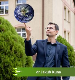
Personal information
Geographer, cartographer, GIS-man.
Assistant professor at the Department of Geomatics and Cartography. PhD in Earth Sciences (geography) in 2017. UMCS graduate, researcher-lecturer since 2015.
Research interests: cartographic visualization, computer graphics, geostatistics with R programming environment, modern methods of analysis and GIS tools in the study of the past (Historical GIS), early topographic maps, the history of Lubelskie region.
Privately: husband & father, sports enthusiast.
Watch my lectures online (Polish):
Scientific Activity
Functions:
2021 - member of the National Committee for the International Cartographic Association 2020 - Secretary of the 12th Polish National Competition of Diploma Theses in the field of cartography, geomatics and geoinformation - more info 2018 - Secretary of the international conference 1st Cartographic Open Plenary Meeting - Lublin 2018: Content, form and function of thematic maps in the era of Geographical Information Sytems - more info
Grants:
2021-2024 - "Digital Research Infrastructure for the Arts and Humanities DARIAH-PL", EU Funds, POIR.04.02.00-00-D006/20, by UMCS in Lublin - scientific coordinator, institute coordinator, researcher 2020-2021 - "Development of the Ortophotomap of Lublin 1939–1945", NCN, Miniatura 4.0, nr 2020/04/X/HS4/00382, by UMSC in Lublin - grant manager - go to the project page
2020-2021 - "Historical Atlas of Polish Towns [part of european HTA series] T. 1. Prusy Królewskie i Warmia, t. 3 Mazury, t. 4 Śląsk, T. 5 Małopolska", grant NPRH no 11H 16020984, by Towarzystwo Naukowe w Toruniu - researcher, GIS specialist, more at http://atlasmiast.umk.pl/ 2019 - "Spatial Development of Lublin", grant MKiDN no 03745/19/FPK/DWIM, by "Grodzka Gate - NN Theatre" Centre - researcher, GIS specialist, cartographic editor, more at http://teatrnn.pl/rozwoj-przestrzenny 2017-2021 - "Innovative system of safety and logistics management in the transportation of goods with the use of geoinformation technologies", NCBiR, POIR.01.01.01-00-0371/17, by FINDEWAL sp. z o.o. - specialist in geoinformation technologies, more info 2014-2016 - "Shtetl Routes. Vestiges of Jewish cultural heritage in cross-border tourism", UE, ENPI, ENPI PBU/0594/11, by "Grodzka Gate - NN Theatre" Centre - GIS specialist, cartographic editor, more info
Publications:
Theses: 2017 PhD: Cartographic reconstruction of the historical urban structure on the example of Bychawa in 1938 - under the supervision of dr hab. Andrzej Czerny, prof. UMCS, Department of Cartography and Geomatics, UMCS Lublin - read PDF 2012 master: The problem of contemporization of the form of presentation of bygone maps - under the supervision of dr hab. Jerzy Mościbroda, prof. UMCS, Department of Cartography and Geomatics, UMCS Lublin. 2010 bachelor: The analysis of the spatial development of Bychawa on the basis of cartographic materials - under the supervision of dr Paweł Cebrykow, Department of Cartography, UMCS Lublin.
Books: - Gładysz-Juścińska M., Kokowski A., Niezabitowska-Wiśniewska B. (red.), 2021: Corpus der römischen Funde im europäischen Barbaricum. Polen. Bd. 4. Lubliner Land, PAU, ISBN: 978-83-66210-21-9 - info (www) - Kuna J., 2018: Bychawa 1919–1939. Kartograficzna rekonstrukcja miasta (Bychawa 1919–1939. Cartographic reconstruction of the town), Maria Curie-Skłodowska University Press, Lublin, 240 pp. ISBN 978-83-227-9075-5 - read PDF - Czerny A., Doroszewicz W., Kuna J. (eds.), 2018: 1st Cartographic Open Plenary Meeting - Lublin 2018: book of abstracts, UMCS, Lublin. pp. 56 - read PDF
Articles:
Kuna J., 2022: The Orthophotomap of Lublin 1944: from Luftwaffe photographs to map application – idea, methods, contemporary challenges of processing and publishing archival aerial photographs, "Polish Cartographical Review", Vol. 54. Nr. 1, pp. 123-142 - doi: 10.2478_pcr-2022-0009.pdf
Kuna J., Jeremicz J., Kociuba D., Niedźwiadek R., Janus K., Chachaj J., 2022: Interactive HGIS platform union of lublin (1569): A geomatic solution for discovering the Jagiellonian heritage of the city, "Journal of Cultural Heritage", Vol. 53, pp. 47-71 - doi:10.1016/j.culher.2021.11.001
Kuna J., Kowalski Ł., 2020: Exploring a non-existent city via historical GIS systems by the example of the Jewish district 'Podzamcze' in Lublin (Poland), "Journal of Cultural Heritage",Vol. 48, pp. 328-334 - doi: 10.1016/j.culher.2020.07.010
Kuna J., 2020: Metoda progresji, retrogresji i kombinowana w kartograficznej rekonstrukcji zabudowy - studium na przykładzie Bychawy w 1938 roku (Methods of progression, retrogression and combined in the cartographic reconstruction of historical settlements - case study Bychawa in 1938) [in:] Konopska B., Ostrowski J., Weszpiński P. (red.), 2020: Mapa w służbie odrodzonej Polski, "Z dziejów kartografii", IHN PAN, t. 23, pp. 205-224.
Kuna J., 2019: Between retrogression and progression – a proposal for a new method to recreate the historical building layout of settlement units, "Polish Cartographical Review", Vol. 51, Issue 4, pp. 215–229 - read PDF
Kuna J., 2018: 'Partially compiled' maps 1:25,000 by Polish Military Geographical Institute (1919–1939), "Polish Cartographical Review", Vol. 50, Issue 1, pp. 31–46 - read PDF ; also available in Polish - read PDF
Kuna J., 2016: Cartographic visualization of Jewish heritage in cross-border tourist project Shtetl Routes (Poland, Belarus, Ukraine), "Polish Cartographical Review", Vol. 48, Issue 4, pp. 173-183 - read PDF
Kuna J., 2015: Metodyczne aspekty analiz przestrzennych GIS wykorzystujących dawne mapy topograficzne (Methodical aspects of GIS spatial analysis using old topographic maps) [in:] Czerny A. (red.), 2015: Dawne mapy topograficzne w badaniach geograficzno-historycznych (Old topographic maps in geographical and historical research), Wydawnictwo UMCS, Lublin, pp. 125-149 - read PDF
Kuna J., 2015: Proste animacje 4D w GIS (Simple 4D animations in GIS), "Acta Universitatis Lodziensis, Folia Geographica Socio-Oeconomica", nr 22/2015, pp. 161-169 - read PDF
Kuna J., Rzucidło A., 2015: Jak zobaczyć informację, czyli różnorodne funkcje mapy w procesie wymiany informacji (How to perceive information - variety of maps' functions in the communication process), "Folia Bibliologica", Vol 57, pp. 87-97 - read PDF
Kuna J., Rzucidło A., 2014: Aleksandra i Daniel Mizielińscy: Mapy. Obrazkowa podróż po lądach, morzach i kulturach świata - review, "Polski Przegląd Kartograficzny", t. 46, nr 3, pp. 319-321.
Kuna J., 2014: Zmiany znaków na XX-wiecznych mapach topograficznych w skali 1:100000 (Symbol changes on 20th century topographic maps in 1:100000), "Polski Przegląd Kartograficzny", t. 46, nr 1, pp. 47-61 - read PDF
Kuna J., 2014: Problem uwspółcześnienia formy prezentacji map dawnych (The problem of contemporization of the form of presentation of old maps) [in:] Konopska B., Ostrowski J. (red.), 2014: Dawne mapy jako źródła w badaniach geograficznych i historycznych (Old maps as a source in geographical and historical research), "Z Dziejów Kartografii", t. 18, pp. 79-92 - read PDF
Interactive maps(online): - Interwar Lublin - go to - Lublin during the Union of Lublin (16th century) - go to - Shtetl Roues. Vestiges of the Jewish Heritage in cross-border tourism - go to
Maps:
Kokowski A., Kuna J., Zawadzki M., 2021. Corpus der römischen Funde im europäischen Barbaricum. Polen 4. Lubliner Land, 1:450 000 [w:] Gładysz-Juścińska M., Kokowski A., Niezabitowska-Wisniewska B., 2021: Corpus der römischen Funde im europäischen Barbaricum. Polen. Band 4. Polska Akademia Umiejętności, Kraków, ISBN 978-83-7676-338-5
Chachaj J., Janus K., Jeremicz J., Kociuba D., Kuna J., Mącik H., Niedźwiadek R., 2019. LUBLIN – rekonstrukcja miasta w okresie Unii Lubelskiej (XVI w.), 1:3 000 [in:] Niedźwiadek R. (red.), 2019. Krakowskie Przedmieście w 450-lecie Unii Lubelskiej , Gmina Lublin, ISBN 978-83-949126-9-7
Kuna J., Kuna A., Majuk E., Tarajko M., 2017: Shtetl Routes: Vestiges of Jewish cultural heritage in cross-border tourism, tourist map 1:900 000, “Grodzka Gate – NN Theatre” Centre, Lublin, ISBN 978-83-65444-08-0.
Kuna J., Kuna A., redakcja kartograficzna, plany miast [w:] Majuk E. i inn. 2015: Szlakiem sztetli. Podróże przez Zapomniany Kontynent, Ośrodek „Brama Grodzka – Teatr NN”, wyd. I, Lublin, ISBN. 978-83-61064-93-0.
Kuna J., Meksuła M.W., Kałamucki K., Bielak A., 2013: 8.1 Rozmieszczenie ludności (8.1 Distribution of population) [in:] Kałamucki K., Grabowski T. (red), 2013: Roztoczański Park Narodowy - przyroda i człowiek - monografia kartograficzna (Roztocze National Park - environment and human being - cartographic monograph), RPN, Zwierzyniec
Kuna J., Meksuła M.W., Kałamucki K., Borek A., 2013: 8.2 Rolnictwo (8.2 Agriculture) [in:] Kałamucki K., Grabowski T. (red), 2013: Roztoczański Park Narodowy - przyroda i człowiek - monografia kartograficzna (Roztocze National Park - environment and human being - cartographic monograph), RPN, Zwierzyniec
Kasiborski P., Kuna J., Łukasik A., Meksuła M.W., Piskorski M., 2012: Szlak Renesansu Lubelskiego - mapa turystyczna 1:150000 (Lublin Renaissance Route - tourist map 1:150000), LROT/Kartpol, Lublin, ISBN 978-83-62664-17-7