

FIELD TRIP 2
How the landscape of Poland's eastern borderlands was shaped (the Roztocze example)
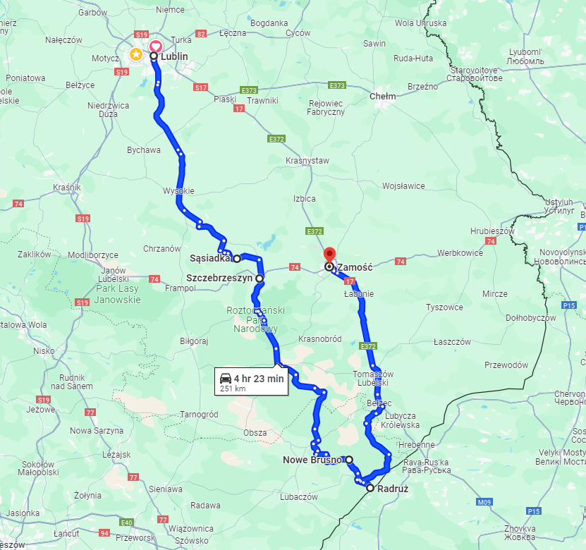
Lublin – Sąsiadka – Szczebrzeszyn – Kawęczyn – Nowe Brusno– Radruż– Zamość
Coordinator(s): Krzysztof Szpara, doctor of Geography at Maria Curie-Skłodowska University in Lublin, Teresa Brzezinska-Wójcik, professor of Geography at Maria Curie-Skłodowska University in Lublin
Keywords: early medieval borderlands of the Kingdom of Poland and Kievan Rus; multicultural heritage; unique, multi-age agricultural and forest landscapes; features of settlement network, changes in the landscape related to the partitions of Poland and World War II
Short description:
The trip's route leads through the Roztocze region, located in the range of medieval historical borders between Poland and Kievan Rus (11th century) and the EU's modern border with Ukraine.
The Roztocze cultural landscape is a result of long-lasting development processes and reflects the values and ideas shared by society as well as a certain type of social and spatial order. It also reflects the function of the area, the characteristics of the culture of a society, its technological capacity and the level of economic advancement.
During the trip, participants will have the opportunity to study examples of the various cultural landscapes of Roztocze and the complicated factors that have led to the shaping of the region's contemporary features.
SĄSIADKA – an ancient Slavic gord, which was one of the most important administrative centres of the so-called “Cherven Towns” (“Grody Czerwieńskie”), a historic region between Poland and Rus. The Cherven Towns was a point of dispute between the Kingdom of Poland and Kievan Rus at the turn of the 10th and 11th centuries, with both sides claiming their rights to the land.
SZCZEBRZESZYN – one of the Cherven Towns located on an important trade route leading from Arab countries through Kiev and Vladimir Wolynski to Krakow and Prague. An example of a multicultural town of the former borderland (synagogue, Jewish cemetery, renaissance churches, Greek-Catholic/Orthodox church).
KAWĘCZYN – rural landscape of Roztocze (characteristic narrow fields), cultural loess forms that began to take shape after 1864, when the enfranchisement of peasants in the Russian partition took place. Szczebrzeszyn and Kawęczyn are located in the Roztocze Transboundary Biosphere Reserve (entry of the Polish part in 2019). The area is inhabited by people for whom agriculture, forestry or tourism is the main source of subsistence. It has a long tradition of using natural resources, including forests and hence, the local people know that their quality of life is among the things that depend on the condition of nature.
NOWE BRUSNO − an example of the impact of political decisions and changes in the course of village borders on the fate of the local population.
RADRUŻ − UNESCO site. St. Paraskevi Greek Catholic Church (tserkva) in Radruż – a gothic, wooden church from the sixteenth century, which together with different tserkvas is designated as part of the UNESCO Wooden tserkvas of the Carpathian region in Poland and Ukraine. The tserkva belongs to the oldest and best kept wooden sacramental architecture tserkvas in Poland.

Photo: An early medieval stronghold in Sąsiadka
Source: http://atlasgrodzisk.pl/component/panarcheowro/?view=details&location=575
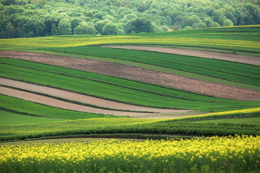
Photo: The agro-forestry landscape of Roztocze
Source: Ministry of Foreign Affairs of the Republic of Poland, https://www.flickr.com/photos/polandmfa/34884764052
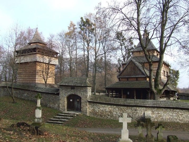
Photo: St. Paraskevi Greek Catholic Church in Radruż
Source: Ewa Skowronek
https://maps.app.goo.gl/qbaNxeqHYE2KiuAV8


