

FIELD TRIP 1
Landscape changes in the Polish-Ukrainian borderland related to World War II
and its consequences in Eastern Roztocze
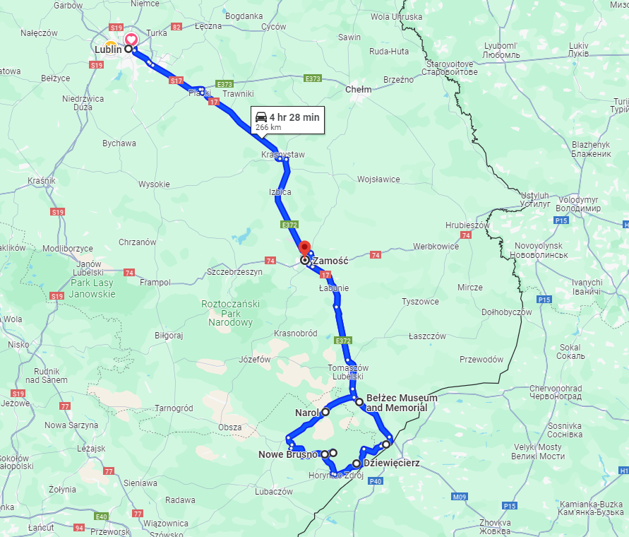
Lublin − Bełżec – Siedliska – Dziewięcierz – Stare Brusno – Nowe Brusno – Narol – Zamość
Coordinator(s): Ewa Skowronek, professor of Geography at Maria Curie-Skłodowska University in Lublin, Renata Krukowska, doctor of Geography at Maria Curie-Skłodowska University in Lublin
Keywords: Polish-Ukrainian borderland, cultural landscape, landscape changes, political factors, holocaust, displacement, changes in population density and land ownership, cultural heritage
Short description:
The route of the fieldtrip leads through the contemporary borderland between Poland and Ukraine, located in the south-eastern part of the Roztocze Region. For centuries it has been exposed to a variety of influences, primarily of a political and military nature. Today, as it was in the past, it is a meeting place of Eastern and Western European cultures, the Roman and the Greek Catholic religions, the Latin and Cyrillic alphabets as well as the Julian and Gregorian calendars.Valuable historic monuments have been preserved in the landscape of the region, reflecting the rich history, cultural and religious diversity and mutual coexistence of its former inhabitants: Ruthenians, Poles, Jews and Germans.
The area was part of the territory of the early medieval Cherven Towns, later it belonged to the Ruthenian principality of Halych-Volhynia and, from the 15th to the end of the 18th century, to the Polish Commonwealth. From Poland’s loss of independence in the late 18th century until the end of World War I, the region was under the influence of Austria-Hungary. Until the outbreak of World War II, it belonged to Poland. At various points in history, the region was split by the border between Russia and the Austrian-Hungarian Empire, the German Reich and the Soviet Union, Poland and the Soviet Union, whereas the present Polish-Ukrainian border is part of the eastern frontier of the European Union and NATO.
The successively shifting borders and the fact that, starting from the Middle Ages, the area belonged to various state organisms had a decisive impact on the formation of the multicultural community and landscape of the region.
Despite various historical events, the shifting borders or ethnic diversity of the population, until the outbreak of World War II the landscape of Roztocze was homogenous and highly valuable thanks to the diversity of the economic activity, spiritual and cultural life of the inhabitants.
Significant changes in the landscape of the borderland comprising Roztocze took place during World War II and immediately afterwards. They were connected with the tragic fate of the local population as a result of various political decisions. Massive displacements, the Holocaust, the demarcation of the new Polish-Soviet border and other actions resulted in a dramatic decline of the region’s population that became almost homogenous ethnic and religious structure. They also led to major and irreversible changes in the landscape, primarily concerning the settlement network, transportation system and land use structure. Other elements of the region’s cultural heritage were also badly affected and impoverished. A very important and new phenomenon was the separate development of the landscape in parts of the Roztocze divided by the new state border.
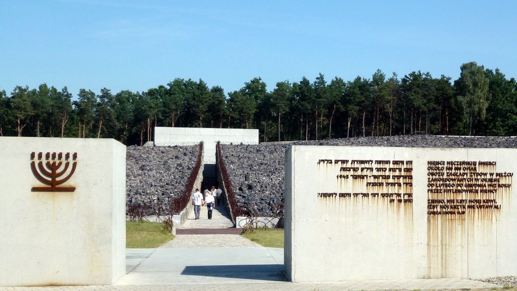
Photo: The German death camp in Bełżec (Museum and Memorial Site in Bełżec)
Source: https://pl.wikipedia.org/wiki/Muzeum_%E2%80%93_Miejsce_Pami%C4%99ci_w_Be%C5%82%C5%BCcu#/media/Plik:PL_Belzec_extermination_camp_1.jpg
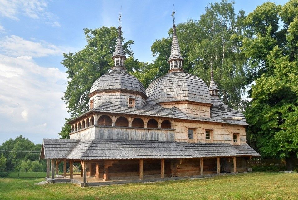
Photo: St. Paraskeva Greek Catholic Church in Nowe Brusno
Source: https://pl.wikipedia.org/wiki/Cerkiew_%C5%9Bw._Paraskewy_w_Nowym_Bru%C5%9Bnie


